I had never been to Mullet Peninsula and as it was along the Wild Atlantic Way I was determined to visit, so much so that I decided that January 2020 was the right time. My closest friends were exclaiming – “why do you want to visit Belmullet, there is nothing there!” The only voice proclaiming any joy about the whole area was John Kierans , who explained that you have to visit Black Sod Head and look over to Achill Island. He was an enthusiastic about Achill Island, which gave me a lot of encouragement about this trip. Even my usual partner in crime, Dec was a little worried that firstly I wanted to visit Belmullet and the Mayo coastline and secondly it was January when the weather on the west coast can be very unpredictable. However as he was doing nothing else that weekend he agreed to come along. So on Saturday the 11th of January we headed off very early across the country and eventually arrived in Belmullet at around 12 noon.
The journey across the country is quite pleasant following the N4 / N5 towards Westport before heading North/ West at Swinford. Belmullet is a sleepy town especially in January and we took a quick walk around the town to bring the legs back to life. The town owes its origin to the establishment of the head-quarters of the commander of the coast guard here, in 1822. It is uniformly built, and contained 117 houses originally. The town did benefit under the “Celtic Tiger” with developments around the harbor and the extremities of the town. These developments now look shabby and some around the harbor are advertised for sale and have been for a while. The town has definitely suffered from the downturn and little investment since. The people however are very friendly and are getting on with life. The harbor and the coastline is the focal point and energy of the town. There is a man made sea water pool in the town along the coast, which would be glorious during the summer. Not however to be used at this time of year unless very brave. After something to eat in a convenient service station we headed out onto Mullet Peninsula to our first destination, Black Sod Head and the famous Lighthouse. There is one main road on which we must travel. The peninsula is quite narrow going south towards Black Sod and we pass the beautiful beaches of Elly Bay and Mullaghroe, both protected within Blacksod Bay. The bay protects two other well known beaches on the west coast of the mainland at Claggan Island and Doolough, so this area has ample beach attractions. At Elly Bay Beach you travel along the narrow point of the peninsula and can see with clarity both Blacksod Bay and the Atlantic Ocean.
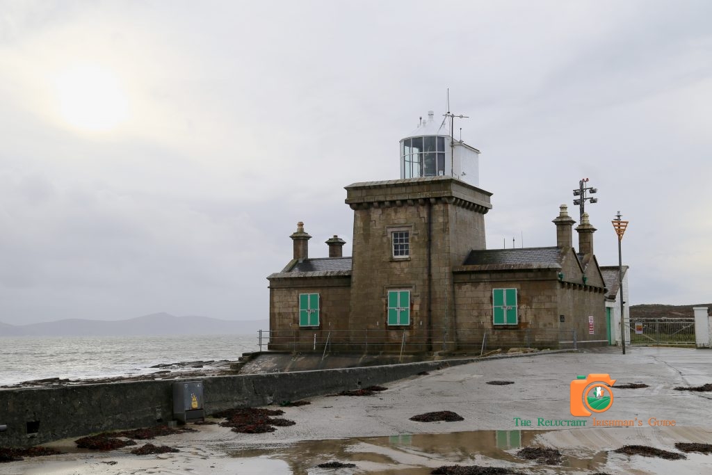
Eventually as we pass Doobeg Point, Black Sod Harbor comes into view. This is a very remote location especially on this cold January afternoon. It feels like you would really need a reason to come here. At the entrance to the harbor we have found our reason, Blacksod Ligthouse.
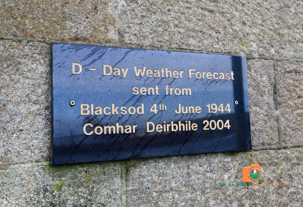
In comparison to all the lighthouses we have visited and there are quite a few, this building seems quite industrial. However considering its location and its historical significance the building is probably functional. During the last war American and British meteorologists used to look out of their respective windows and very rarely came up with the same weather forecast. Obviously, an accurate forecast was essential for the D-day landings in France in 1944. At Blacksod Lighthouse the weather station was being manned by Ted Sweeney, an Irish Coast Guardsman.
In the history of mankind, few weather forecasts have carried such importance. Lighthouse keeper Ted Sweeney had no idea the lives of more than 150,000 Allied troops would hang on his weather report.
It was a fateful call. As he watched the barometer fall precipitously, Ted Sweeney’s report from the Coast Guard station convinced General Dwight D Eisenhower to delay the D-Day invasion for 24 hours – a decision which averted a military catastrophe and changed the course of the Second World War.
The weather report, which made up the minds of the British to prove they were correct and recommend invading came from the Blacksod Point Meteorological Station! So the Blacksod Lighthouse and Meteorological Station had an important role in World War II as Ireland remained neutral.
Before making the trip I had read about Tír Saíle. Tír Sáile, The North Mayo Sculpture Trail is the largest public arts project ever undertaken in Ireland. The project was developed in 1993, during the Mayo 5000 celebrations, a year-long cultural celebration of life in Mayo inspired by the historic Ceide Fields landscape. The development of the sculpture trail – originally initiated by artist-initiator Marian O’Donnell at a symposium related to the discovery of the Céide Fields. This entailed the putting in place of fifteen mixed media sculptures based at some of the most spectacular locations all along the North Mayo Coast, stretching from the Moy Estuary to the tip of the Erris Peninsula. Finding the structures takes visitors right off the beaten path into the heart of the landscape.
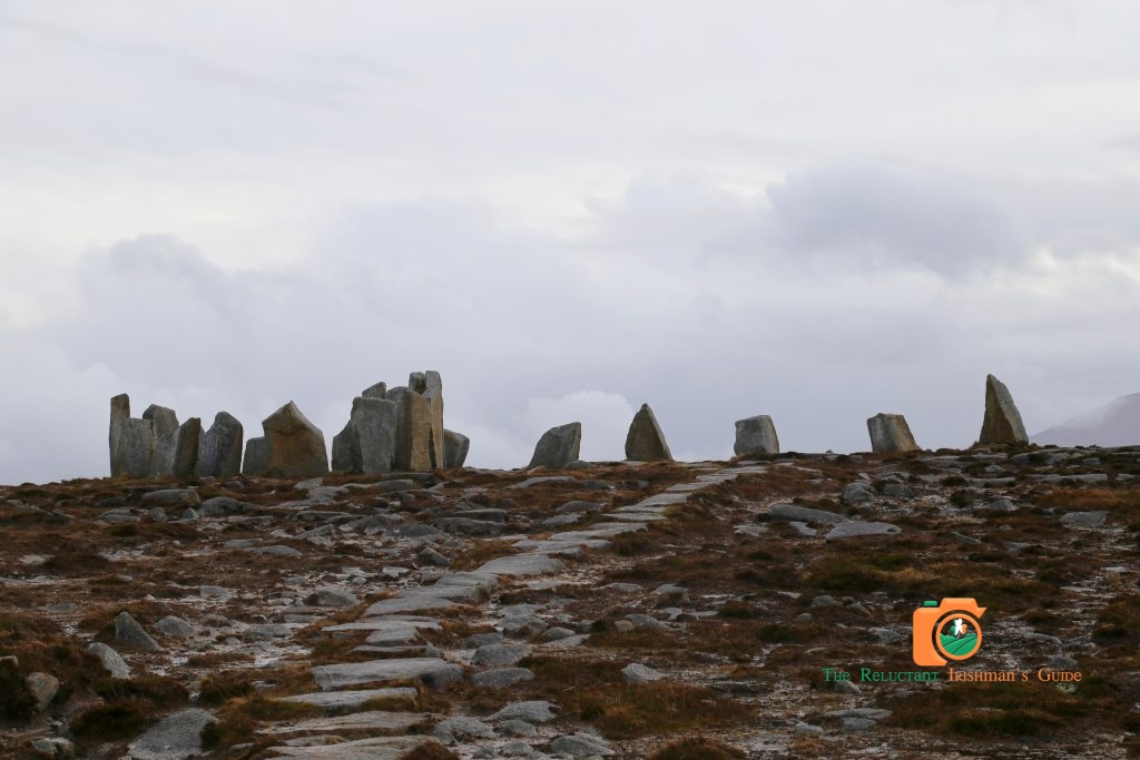
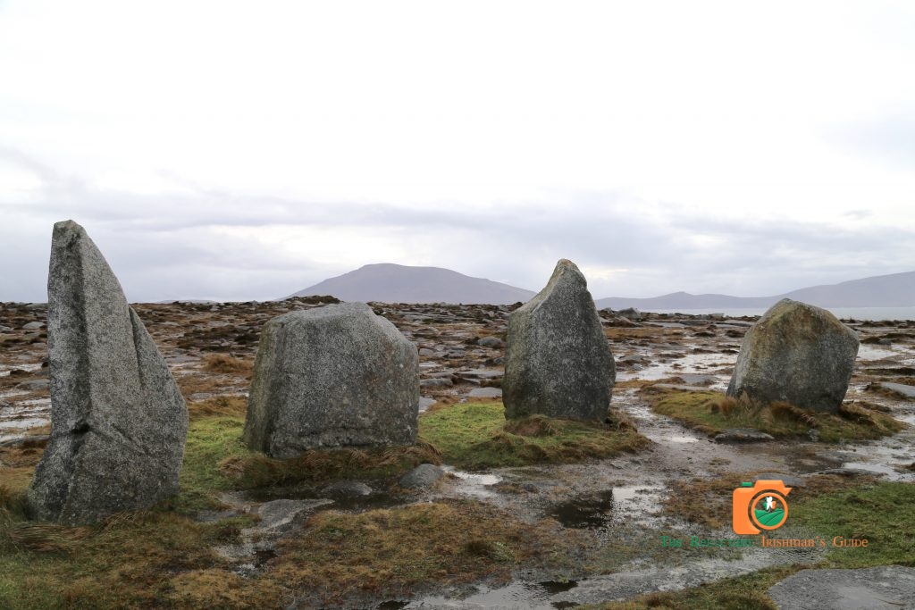
There were two we planned to visit today and the first, “Deirble’s Twist”, was not far from Blacksod on Fallmore peak. This is a magnificent setting even on this cold winter afternoon. While the setting of the standing stones is man made, they suit this location with the formidable Slievemore signifying Achill Island across the bay. The sun broke through the clouds for a short time to reveal the Islands of Iniskea North and South in the distance. A magical viewing point in a regal setting. You would expect Arthur and his Knights of the Round Table to appear at any moment. A simple and amazing sculpture in the perfect location.We headed on around the loop, around Termon Hill, back on the road to travel north again.
Both being golfers we had planned to call into Carne Golf Club. This golf course is very well regarded in golfing circles, attracting its fair share of foreign visitors which is very impressive considering its far out location on a peninsula virtually in the Atlantic. As in most golf clubs we were welcomed and made to feel at home. As the day was very windy and cold the course was empty, but you could see from our short walk around the first tee that this course was a challenge and the wind would be handicap to any average golfer, so Dec and I were goosed.Our lunch of a soup and sandwich was very tasty and we were very well informed by the waitress and the bar manager about the usual visitor to the course and the various open days if you wanted to return. We were even told to go down to the Pro Shop and the Professional would lend us a few clubs to play three or four holes, free of charge. Any other day we would have taken this offer gladly especially as the course looked very impressive from the Clubhouse. Before leaving we did visit the Pro Shop and were enthusiastically informed of the various open days and the possible deals if we returned. A very friendly Club with every employee working to sell their club and ensure people return, a rare quality indeed. We will return soon to loose many golf balls in the wind !!

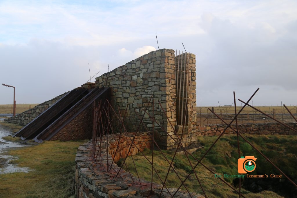
We then headed west towards the next sculpture on the Tír Saíle trail, Dún na mBó. This man made structure is more industrial but again the setting is wild. The Atlantic Sea around this location is battering the rock cliffs for as far as you can see, with waves breaking into foam and onto the shore. Situated on top of the cliffs with uninterrupted views of the Atlantic, this Discovery Point is one of the wildest in Erris. The sculpture has been built here around a blowhole, allowing visitors to experience the wild Atlantic waves pushing up through the land! The sculpture at the blowhole is accessible via a pedestrian gate. The blowhole was very active when we visited this attraction. You could really feel the force of the Atlantic undermining the coastline and releasing its power through this hole in the ground. A short distance from Dún na mBó the most amazing location comes into view, Eagle Island, with its own Lighthouse and buildings. Two lighthouses were built on this island, Eagle Island East and Eagle Island West. However the island’s location far off the mainland has resulted in many storm incidents which resulted in damage to both lighthouses down through the years. Unfortunately in one of these incidents the Eagle Island East tower was damaged beyond repair and it was decided to concentrate on improving the remaining tower. The Lighthouse on Eagle Island was destined to suffer from severe storms. Substantial damage was again done by storms in January 1987 and February 1988. This was a surprise location for our day on Mullet Peninsula.
On 31st March 1988 the lighthouse was converted to automatic operation and the Keepers were withdrawn from the station. The Island is a photographer’s dream as it is being constantly attacked on all sides by the sea.
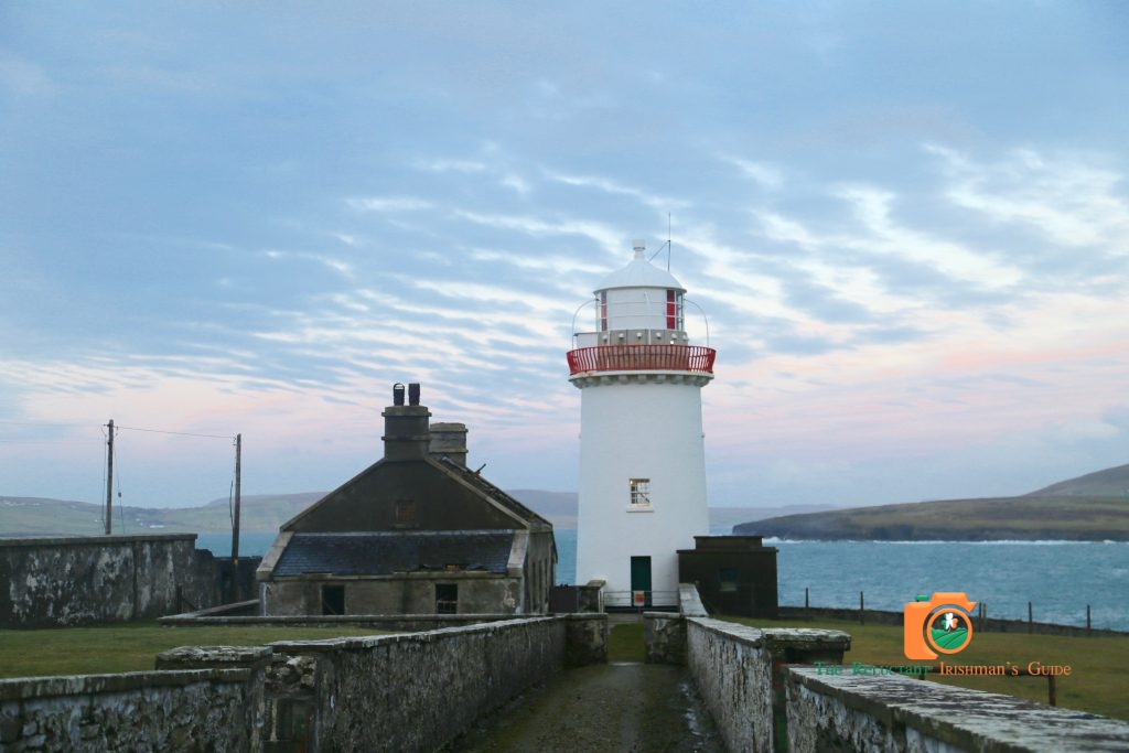
As the light was beginning to fade we headed east across the peninsula towards another lighthouse, Ballyglass Lighthouse which protects shipping traveling into Broadhaven. It is located on a headland between Erris head and Benwee Head. The Lighthouse guides vessels from seaward clear of a sunken rock on the western side of Broadhaven into a safe anchorage. Ballyglass Lighthouse (also known as Broadhaven Lighthouse) is located on the north eastern tip of the Mullet Peninsula in County Mayo overlooking Broadhaven Bay. The 15 m tall tower was erected in 1848, but the light was first established on 1st June 1855.
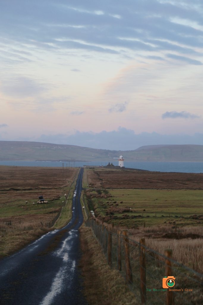
On passing the town and harbor of Broadhaven you head north as if you are heading towards lands end. The road to Ballyglass Lighthouse is all down hill towards the lighthouse in the distance. The road has vegetation growing in the middle which is a good sign that many do not pass this way, in the winter months anyway. We eventually come down to the lighthouse and we are faced with the usual high while walls and locked gate. To our surprise there is a car full of occupants parked directly outside the walls. They seem to be of Eastern European origin and the faces display the same surprise concerning our late appearance on this evening. The evening is getting settled for sunset and we must work quickly.
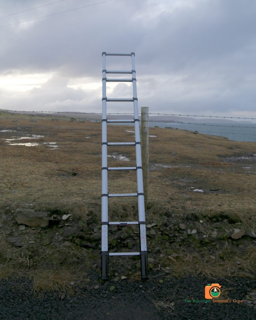
As Dec gets ready to climb over gates again I direct him to the rear of the van. I have a surprise for him after our last visit to Valentia Island Lighthouse. On throwing open the back doors a bright shinny collapsible ladder appears into view. “Dec we are getting too old to climb gates and risk injury, you being retired and all that”. We released the ladder and picked the best location on the wall to capture the best photograph of the lighthouse. The ladder had given us a new high prospective on this remote lighthouse. The occupants of the car were becoming a lot more inquisitive about the two middle aged men, who were setting up quickly and climbing this ladder alternatively. They did not exit the car however. This was a beautiful location and we could capture the entire building with our new addition to the necessary equipment, the ladder. Most lighthouses are in remote locations because of their use but Ballyglass feels extraordinarily remote as it is so far north on this peninsula. The lighthouse buildings and walls take up all available lands and there is no way to see the lighthouse from either side. The only other perspective is from the sea itself. Sunset was upon us so we decided to head back to Belmullet for the night. Our neighbors in the car seemed to be in deep conversation having forgotten about the late visitors with cameras.
We headed back to the Broadhaven Bay Hotel for the night. We had passed the hotel when coming into Belmullet. Although a three star hotel, the hotel is located on a prominent location looking out to the bay. The car park was full so Dec remarked that the hotel may be full of life with a wedding in progress. We were disappointed however as the hotel was the location for a well attended funeral aftermath. The hotel itself is very well designed and maintained and provided the perfect location for our one night stay. Bar food was excellent and the staff were very friendly. We headed to bed early to make the most of our second day in North County Mayo.
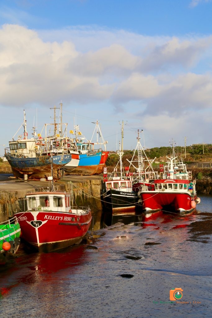
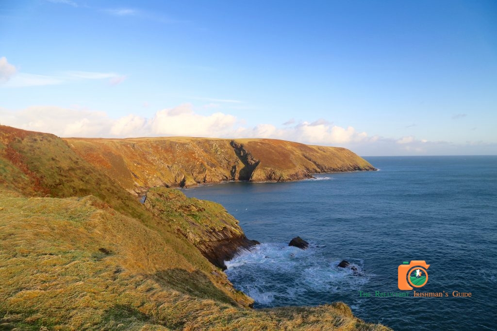
We rose early and after a very well prepared breakfast we headed out again firstly to Belmullet Harbor, to take some photographs. This was a fresh morning and the fishing vessels were awaiting preparations for the next journey, patiently. A beautiful morning with the sun gently caressing the bay. We had missed one location on the peninsula the day before and we were heading there now, Erris Head. On our way back from Ballyglass the night before we had passed the road to Erris Head, but had decided we would have seen very little with what remained of the evening. Our decision to postpone this journey was wholly justified as we traveled along the high road to Erris Head. We eventually arrived the carpark signifying we had arrived at the start of the loop walk. We were totally alone when starting the walk except for some adventurous sheep who had perfected the art of climbing along the cliff face without any fear or safety precautions. They only seemed to look back occasionally at the two visitors that were having difficulty traversing the first stage of the field climb to the head. The morning was perfect for our walk but the lands around the loop were quite wet and slippy, so care had to be taken. We were expecting a fall but this event was avoided on the way up. The view from the head is amazing and you can look out to sea or back down the peninsula. The perfect way to start the day and we got the required steps in for the day in this walk alone. The descent from the loop was equally as dangerous so we headed down the field taking the driest route possible. When arriving at the final gate I took the anticipated slide but successfully held my balance to grab the wooden gate and keep all limbs upright. Any ice skater would have been proud of the performance. Dec eventually stopped laughing in the van. A must visit location and hopefully you get the same morning.
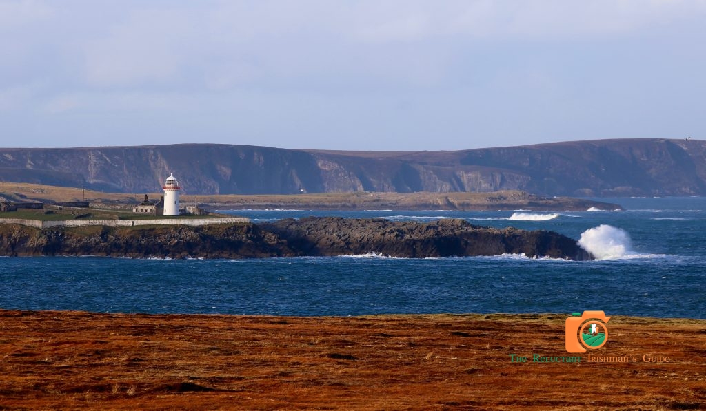
We headed back through Belmullet and took a brief tour to Claggan Island to the south of the town on the coastline. Claggan Island (Oileán Chloigeann) near Belmullet, Co Mayo on the west coast of Ireland is relatively new!! Linked to the mainland by a narrow, sandy causeway, it was only officially declared an island in 1991. With a population of only 8 people this slice of coastal tranquility is a must for those searching wonderful scenery. The views of Achill (Slievemore in its splendor) and the Mullet Peninsula are stunning and the island itself is a Discovery Point on The wild Atlantic Way. As time is passing quickly we head along the northern coast towards Belderg and our next destination, The Ceide Fields.
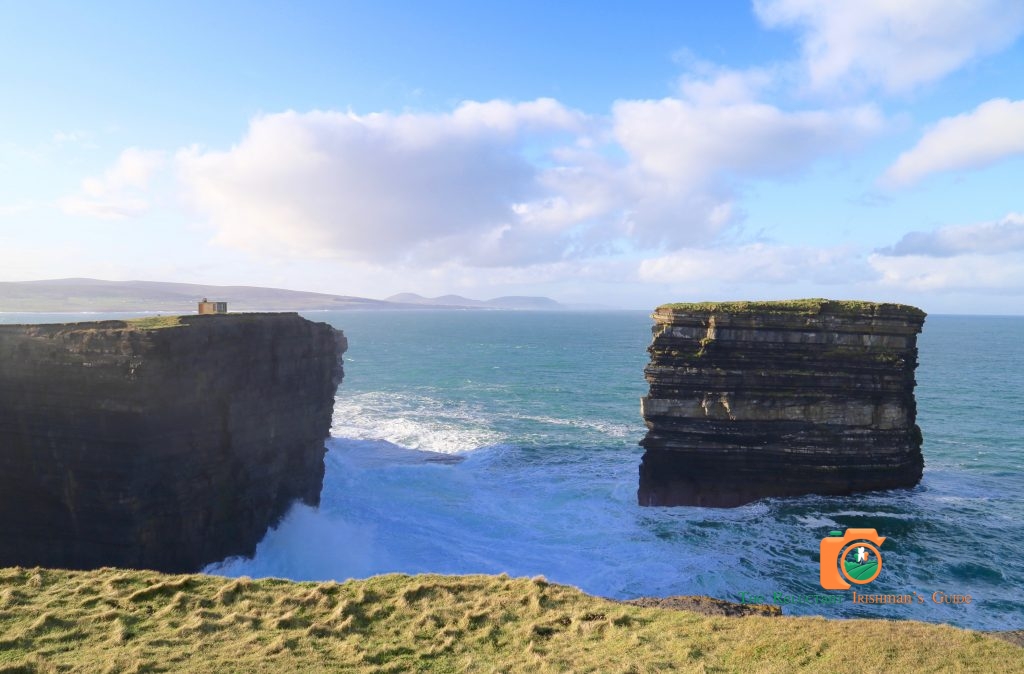
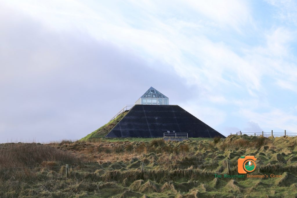
Beneath the wild boglands of North Mayo lies the Céide Fields, the most extensive Stone Age monument in the world, consisting of field systems, dwelling areas and megalithic tombs. The stone walled fields, extending over thousands of acres are almost 6,000 years old, the oldest known in the world. They are covered by a natural blanket bog with its own unique vegetation and wildlife. The Visitor Centre has won several awards, including the Gold Medal for architecture. We were unfortunately unlucky on this January morning as the visitor center was closed until later in the season. The visitor center is very impressive and looks out towards the sea with Downpatrick Head in the distance. This is an impressive coastline on this fine winter morning. The lands surrounding the site of the Ceide Fields is bog based and very soft under foot which accounts for the preservation of the stone structures in this area. Definitely have to visit the Ceide Fields again when the visitor center is open as this is a very historical site. One of the attractions that i was really looking forward to seeing was Downpatrick Head. The view from the Ceide Fields was a little underwhelming as the cliffs looked very ordinary in the distance. We drove through Ballycastle and out to the headland.
As we pulled up at Downpatrick Head the whole location turned into the epic attraction I had been expecting.
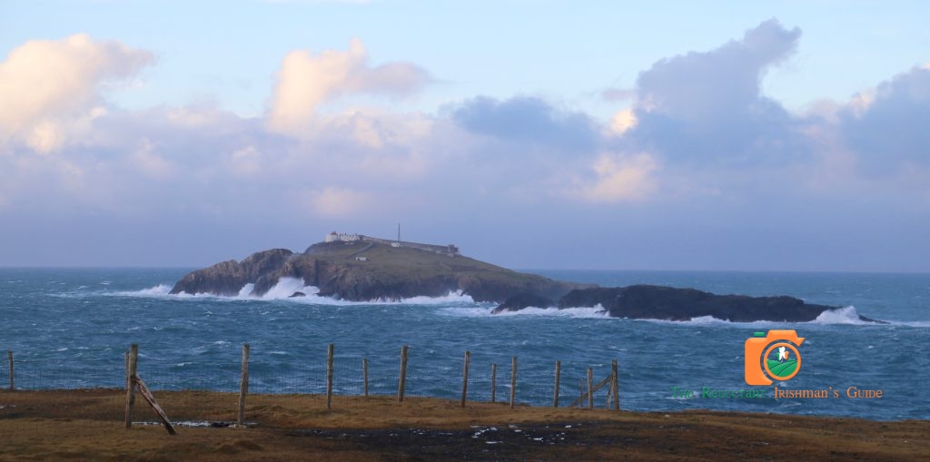
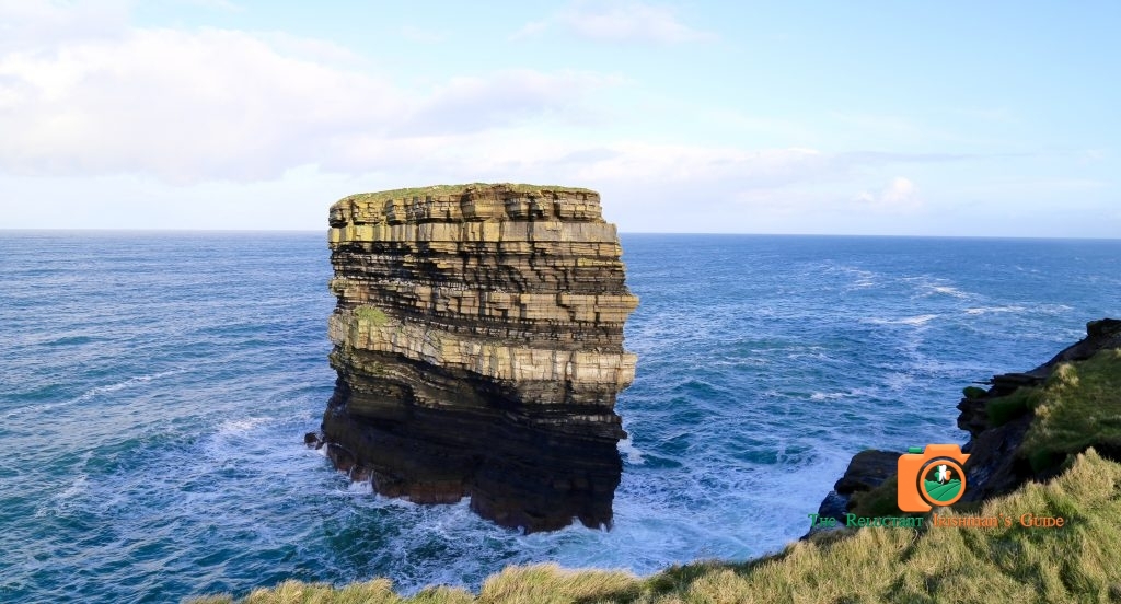
Downpatrick Head is a majestic heritage site. Jutting out into the ocean and rising almost 40m above the waves, it provides unparalleled views of the Atlantic, including the unique collection of islands known as the Staggs of Broadhaven. You can also spot the nearby Dún Briste ( Broken Fort ) sea stack, with its different coloured layers of rock and nesting sea birds. In addition to the natural scenery and wildlife, Downpatrick Head is home to the ruins of a church, holy well and stone cross, which together mark the site of an earlier church founded by St Patrick. Ireland’s patron saint is also honoured with a statue that was built in the early 1980s. Given its religious associations, Downpatrick Head was once a popular destination for pilgrims, who came here each year on the last Sunday of July, known as ‘Garland Sunday’. Today that tradition lives on, and mass is still celebrated at Downpatrick Head on that same day.
The sea stack is impressive as it is being attacked on all sides by the sea. The sea is relentless and the various nestling birds make the location a hive of activity both on and off the stack. You can edge yourself close to the cliff edge to take the best photographs of the cliffs with sea stack in the foreground. The ground close to the cliffs is spongy as if ready to give way so this adds to the danger and dramatic location. The ground seems to be covered with mossy pockets of air. The most unusual feeling when traversing the headland to find the best view of the cliffs and the sea stack together. This is a relatively new sea stack as it was only separated of the mainland Ireland in 1393 when monster seas severed it from County Mayo in an overnight storm. The summit of the stack is approximately 50 metres long and 15 metres across the centre. This flattopped stack contains the remains of the buildings where people were living on the night of the great storm. This is one of the most memorable and unexpected locations of all our trips around the Wild Atlantic Way. We took our time here to take in the majesty of this location and enjoy the ferocity of the surrounding sea. I am sure the sea stack will eventually succumb to the sea but we have plenty of time to enjoy this accident of nature and its special home to the local sea life.
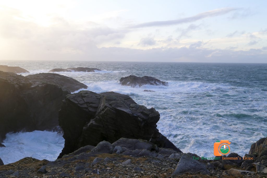
We eventually headed along the northern coast and soon came across Lackan Strand. Lackan Bay beach is located along the North Mayo coastline, between the towns of Killala and Ballycastle. The beach looks out onto the Atlantic and offers a breath-taking view of the North West coast. Lacken is the site of the French landing at Kilcummin Strand in 1798 and the start of General Humbert’s march to Ballina. Another beautiful location on this amazing coastline. Lackan Strand is also the location for an annual horse racing event. This is always a very spectacular and colourful event, and all races take place along a six-furlong oval track. To finish our journey we head towards Killala.
Killala (in Irish: Cill Ala) is a picturesque seaside village six and a half miles north-west of Ballina in north Mayo, famous in Irish history for the part it played in the 1798 rebellion.
In August of 1798 General Humbert arrived into Kilcummin pier from France and combined with the Irish forces against the English forces in the area. This year is chronicled in Irish history as the Year of the French and a book and television history celebrate this unique event. Consequently, Killala has become a popular location for the historian and in fact was used as a major location for the 1981 multi million pound film “The Year of the French”. In 1998 Killala celebrated the bicentenary by twinning with a town in Chauve in France.
Killala’s skyline is dominated by a round tower, dating to the 12th century, a testament to the historic distinction of the village as an ecclesiastical centre. Killala is a popular tourist destination with many amenities and activities to entertain visitors of all ages. There are beautiful, unspoilt beaches in the region, including nearby Ross – a Blue Flag beach, excellent for swimming and other watersports.
A strong tradition of fishing prevails in the area and the village harbour is a focal point for many visiting fishermen. Other locations for fishing include river, shore and offshore fishing.
So we have come to the end of our short trip to North Mayo and the Mullet Peninsula. We are both in agreement that the trip has been a real eye opener and an amazing experience, even after all the negative comments about this part of the country. We were even blessed by the fine weather in January. When you are not expecting much you can only be surprised. However Mullet Peninsula and North Mayo have plenty of wonderful locations and definitely worth a short trip. We headed through Ballina and back onto N4/ N5 and home.
